Area: 2,468.7 sq. km
Population: 882.0 thousand habitants (2015).
Capital: Bac Lieu City.
Districts: Hong Dan, Vinh Loi, Gia Rai, Dong Hai, Phuoc Long, Hoa Binh.
Ethnic groups: Viet (Kinh), Khmer, Hoa, Cham...
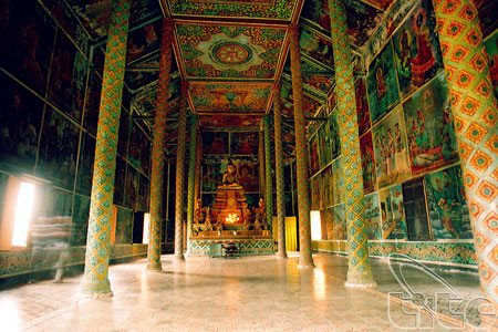
Xiem Can Pagoda (Bac Lieu Province)
Geography
Bac Lieu Province situated in the Mekong River Delta. It shares its border with Can Tho City and Soc Trang Province to the north, the East Sea to the south, Ca Mau and Kien Giang provinces to the west. Bac Lieu has many large rice paddies and fertile land, which make a good condition for fruit tree planting.
Climate: the weather is divided into two seasons: rainy and dry seasons. The annual average temperature is 240C.
Tourism and Economy
Bac Lieu City is on side of Bac Lieu Canal, 10km from the sea. Bac Lieu residents grow rice, fruit trees, catch seafood and make salt.
Bac Lieu used to play importance role in exploitation and developing of French colonialists so that the province has existed several western-style villas and palaces.
Coming there, tourists have more knowledge about very rich and popular Bac Lieu Mandarins. And they can visit the Bac Lieu Bird Reserve, unforgettable taste longan gardens, Viet Hung old Tower, Xiem Can Pagoda or discover mangrove cajeput forest.
Transportation
Bac Lieu is 280km from Ho Chi Minh City, 67km from Ca Mau, 50km from Soc Trang, and 113km from Can Tho. The National Highway No. 1A crosses the province and links to Soc Trang and Ca Mau provinces.